


Drone mapping or aerial surveying in construction provides the end deliverables in the form of maps. The two common types of drone mapping methods are photogrammetry and LiDAR. Both the methods give different mapping outputs and require specific data processing software to study the data.
This article discusses the common maps delivered after a drone survey or mapping process.
Types of Maps in Drone Mapping
The common types of maps obtained from drone mapping are:
- Orthomosaic maps
- Digital Elevation Models (DEM)
- Digital Surface Models (DSM) and Digital Terrain Model (DTM)
- Contour line maps
- 3D point clouds
- 3D textured maps
1. Orthomosaic Maps
An Orthomosaic map or ortho-map is a top-down map of a survey site. It is a composite image obtained by the camera by viewing straight down to a survey site or asset. Digital images are taken using drones and stitched together to create a 2D orthomosaic map. This map is developed when the area to be surveyed is large.

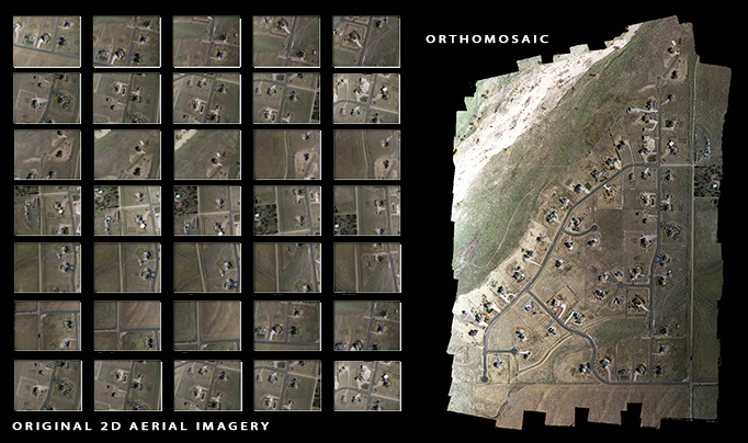
A drone with high-resolution cameras helps develop detailed and centimeter-accurate georeferenced ortho-maps.
An ortho-map provides a real-world view that facilitates rapid decision-making and analysis to study the project progress.
2. Digital Elevation Models (DEMs)
DEMs are a visual representation of elevation data for every point captured on the site by the drones. Instead of an actual representation of the site, DEMs use colors to indicate the elevation difference.


DEMs generate grids that list the highest vertical point along the z-coordinate for every x and y coordinate. A smaller grid cell implies more detailed information within the DEM data file. It provides models of the terrain with lots of details.
3. Digital Surface Model (DSM) and Digital Terrain Model (DTM)
DSM and DTM are a subset of DEM. DTM provides a bare-earth surface model featuring the pure terrain and the ground, while DSM provides all the acquired points and represents all the man-made and natural features on the earth's surface.
The figure below shows DTM and DSM models. DTM follows the ground, whereas DSM shows the ground.


DSM shows the structures on the surface, i.e., the top of the buildings and the trees.
4. Contour Line Maps
Contours or Topographic maps are two-dimensional maps consisting of lines that join equal elevation points. These lines are called contour lines. Contour maps reveal peaks and valleys, mentioning the steepness of the slope.
A DTM or DSM model with custom contour intervals creates a contour line map. This gives a better idea of the surface of the area shot by the drone.
5. 3D Point Clouds
A 3D point cloud generates a densified point cloud from the drone images. It is made from thousands of points, each being a geometric coordinate. Each point provides geospatial (x,y,z) and color information. All these coordinates are combined to build a 3D model. As the number of coordinates increases, the model becomes denser.

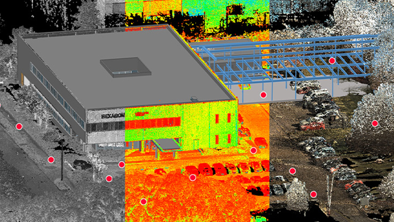
Image Credits: HEXAGON
3D point clouds give an accurate model whose distance, area, and volume are easily measured.
6. 3D Texture Mesh
A 3D texture mesh is an evolution of 3D point clouds. It reproduces the edges, faces, vertices, and texture of the area that is shot by the drone. It is suitable for visual inspection and ideal for monitoring project progress.
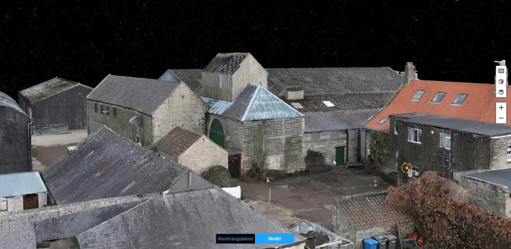
Image Credits: Heliguy
FAQs
DEMs are a visual representation of elevation data for every point captured on the site by the drones. Instead of an actual representation of the site, DEMs use colors to indicate the elevation difference.
DTM provides a bare-earth surface model featuring the pure terrain and the ground, while DSM provides all the acquired points and represents all the man-made and natural features on the earth's surface.
A 3D point cloud generates a densified point cloud from the drone images. It is made from thousands of points, each being a geometric coordinate. Each point provides geospatial (x,y,z) and color information. All these coordinates are combined to build a 3D model. As the number of coordinates increases, the model becomes denser.
Read More